CONSERVATION SECTIONS
Johnville Bog and Racey Brook
 In the past, part of the peat bog belonged to the Borough of Lennoxville which, through several land acquisitions in the 20th century, pursued the objective of securing its drinking water supply. Water from the esker was the main source of supply for Lennoxville between 1921 and 1949, before becoming a secondary supply until 1986. Following municipal mergers, the City of Sherbrooke became the owner of the land, before transferring it to the University of Sherbrooke and Bishop’s University in 2010.
In the meantime, Nature Eastern Townships (NET) became the owner of a 44-hectare piece of land in 2007, next to what would become part of the universities’ property. With this acquisition, NET wishes to perpetually preserve these natural environments and restore the portion of the peat bog that was previously degraded. The restoration work carried out in 2013-2014 includes activities such as the building of dams, blocking of culverts and cutting of woody vegetation. It aims to restore the water table levels in this area of the bog, reduce erosion and sediment transport to Racey Brook, and promote the return of plant and wildlife species usually found in open bog ecosystems.
To protect the natural environment of the bog area, a conservation easement now links the universities’ property to that of NET. This status provides legal protection for over 227 hectares, which represents 94% of the total area of Johnville Bog.
To learn more about the recreational and educational opportunities at Johnville Bog & Forest Park, click here
The main tributary to Johnville Bog is Racey Brook. The Racey Brook watershed covers an area of 26 km2. There are 52.63 linear km of streams and 30 water bodies. The major water bodies are Jenckes Lakes and Arthur Langford Pond, both of which are directly associated with the hydrography of Johnville Bog.
Johnville Bog is characterized by the presence of an esker, an area of fluvioglacial sand and gravel deposits formed by the flow of water beneath the glacier. It is the presence of this esker to the west and south, combined with the presence of impermeable deposits such as clay, that would have prevented the drainage of land further east and encouraged the accumulation of organic matter that led to the formation of the Johnville Bog. The presence of the esker affects the topography surrounding the bog by creating a succession of knolls and depressions, thus affecting the location of the various forest stands.
Bogs can be categorized into two main groups: ombrotrophic bogs (bog) and minerophilic bogs (fen).
The Johnville Bog ecosystems are a variety of ecosystems including sphagnum spruce-moss, wet cedar, hemlock and mixed maple, as well as:
34
species of mosses and over 350 species of vascular plants
12
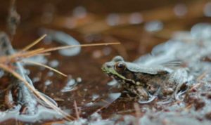
species of amphibians
and 2 reptile species
PROJECT PartNers: